ACTIVITIES
Surroundings
Hiking in the area around the finca
If you don't want to go on a bigger tour right away, you can start by walking upstream from the finca. Following the dirt road, you will come to the fence of the neighboring property after about one kilometer. Don’t hesitate to enter (but please close the fence again) and hike south up the hill. Passing sugar cane and coffee fields, the path goes uphill and you will have beautiful views of the valley of the Rio Tuis and the surrounding mountains. After about one to one and a half hours you will come back to the main road, from where you will have a magnificent view. You can now follow the main road down towards the finca to complete the circuit. If you would like to go even higher you can continue hiking uphill. After about 3 km the road ends at a private property.
Excursions
For those who like to hike and explore the area around the finca to enjoy beautiful views, there are plenty of options. Apart from the paved road (232) that leads from Turrialba to La Suiza and further to Platanillo and Chirripo, there are only unpaved roads in the region, comparable to our forest roads. Beautiful hikes can be made to Las Colonias, Sta. Cristina, to Tuis or to Pacayitas. The area is also excellent for mountain bike tours.
Orosi
Orosi is known for its church. The town has the oldest still existing church in Costa Rica. It was completed in 1743 and has survived all earthquakes since then almost unscathed. For many devout Catholics, this borders on a miracle. Orosi is not only worth a visit because of the church. Orosi is located in a scenic, fertile valley through which the Rio Reventazón meanders. It is the second most important river for rafting tours after the Rio Pacuare. In the Orosi Valley there are also extensive coffee plantations, hot volcanic springs, and not far away, the Tapantí National Park, through which the Rio Orosi flows. You can get to Orosi by driving to Turrialba and then taking the highway to San José. Make sure that you do not continue towards Cartago in Paraiso, but turn off towards Orosi. The turn is signposted and after about 5 km you will reach the village.
Tapantí
Tapantí National Park is located a few kilometers south of Orosi and is easily accessible from there via a gravel road. Tapantí is the rainiest area in Costa Rica and one of the three rainiest in the world. The rainfall is over 6,500 mm per year. Therefore, you should not forget rain gear when visiting! This abundance of water naturally has an impact on flora and fauna. You can marvel at lush primary forest. The National Park is home to an extraordinary variety of animals, some of which are endangered, such as ocelots, weasel cats, tiger cats, jaguars, raccoons, armadillos, coatis, pakas, agoutis, howler monkeys, capuchins, hummingbirds, sparrow hawks, falcons, quetzals and tapirs. Tapanti is the Indian word for tapir. The park covers an area of nearly 60,000 hectares and ranges in elevation from 1200 meters to 2560 meters above sea level. You can explore a small part of the park on several hiking trails that are well signposted. The rangers at the park entrance will hand you a map upon entry, which is very helpful. If you visit the park, don't forget your bathing suit, as there are beautiful spots along the Orosi River to swim and linger. Costa Ricans like to visit the river for weekend excursions and barbecues.
Turrialba Volcano
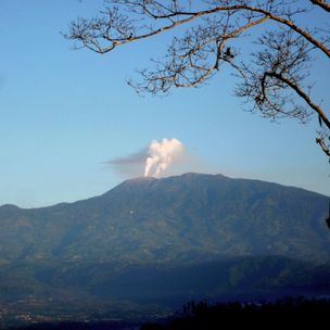
The volcano Turrialba (3340 meters in hight) is the second highest and one of the most beautiful accessible volcanoes in Costa Rica. It is located in the Volcan Turrialba National Park. The ascent through the park in itself is amazing, as you go through cloud and rain forest. In higher zones you are reminded of a fairy tale forest by large ferns and large-leaved plants. With a little luck you can see hummingbirds and also quetzals. On a clear day you can see Irazu, Poas and Barva - all volcanoes of the Central Cordillera. All in all, the summit offers a wonderful view of the surrounding area, which is characterized by dairy farming. If you like to hike far away from the hustle and bustle, this is the right place for you, because the national park is not very well developed - i.e., you can't drive to the crater rim - and therefore relatively little visited.
In 2006 Turrialba came back to life and since then it smokes sometimes more, sometimes less and spits some ash from time to time. Before you plan a tour, you should check with the park administration whether the national park is open.
Active
Costa Rica is known for combining adventure tourism and ecotourism in an excellent way. Sustainability is especially emphasized. To round things off, efforts are also made to involve the population and especially the indigenous people, who often live in nature reserves, and to convince them of the value of sustainability. Therefore, countless educational and social projects are supported.
Costa Rica offers excellent rafting conditions and is world famous for it. The region around Turrialba is crossed by the Pacuare and Reventazón rivers, which are among the ten best rafting rivers in the world. The Pacuare has even made it into Outdoor magazine.
The entry points are not far from La Suiza. Therefore, you can easily join one of these tours from the finca. A rafting tour combines breathtaking nature experience with sportive challenge. You will steer through white water of warm tropical rivers, past thundering waterfalls and rocks as high as houses, through dense, high rainforest. With a little luck you will see some wild animals in calmer sections of the river in this untouched nature. Surely an unforgettable experience!
Apart from rafting, canyoning, guided hikes, tours by mountain bike or on horseback are offered. An extraordinary way to move through the jungle is to fly on a wire rope stretched from treetop to treetop 20 meters above the ground - canopy! Canopy is fun and you can get to know the rainforest from a bird's eye view. Of course you are secured with harnesses and carabiners. People with height problems should nevertheless rather stay on the ground.
Culture
Guayabo National Park
At the foot of the volcano Turrialba, about 20 km northeast of the city of the same name, there is an excavation site where you can discover remains of a pre-Columbian settlement.
There are remains of paved roads, aqueducts, cisterns, meetings, petroglyphs, tombs and sculptures. The city is said to be over 3000 years old and to have housed 10,000 people at the best of times. The size of the complex and the buildings indicate that the former inhabitants had extensive knowledge of architecture and urban planning. In addition, a large labor force must have been available.
The excavation site is surrounded by dense rainforest, which is home to many species of bromeliads, orchids and birds. From a hill you have a beautiful view over the whole site. An excursion is therefore always worthwhile. After a visit to Guayabo, it is a good idea to visit the beautiful town of Santa Cruz and stop there for a coffee. Santa Cruz is known for its dairy industry and cheese production. You can buy there an excellent "queso blanco", the Costa Rican soft cheese. A little outside on the road to Cartago is a nice excursion restaurant from which you can enjoy a magnificent view over the Turrialba Valley.
Alto Pacuare, Chirripo and excursion to the largest National Park in Costa Rica: Parque Internacional de la Amistad.
An excursions to the Indian Reserve is most interesting. About 4000 Cabecar Indians still live there. The reserve extends from the northeast slopes of the Talamanca Mountains to the Caribbean coast. Alto Pacuar is located on the Rio Pacuare. Approximately 600 people live in this community. However, Alto Pacuar is not a village as we know it, but the inhabitants of this municipality live widely scattered. A house may well be located at a distance of two hours walk from the village center.
You can get there by continuing on the main road from La Suiza towards Tuis via Platanillo to Jicotea. You can also get to Jicotea by bus. From there it is about 10 km to Alto Vereh. From here you can only continue by motorcycle or best on foot. After about three hours you reach Alto Pacuar. It is interesting to see how the Indios live and stay at the Rio Pacuare.
If you continue the road to the southeast, you will reach Moravia, and depending on the vehicle, Chirripó. From there, an Indian reservation extends to Cerro Chirripó. You can reach the Cerro (summit) after a two-day hike. For this, however, one should definitely take an Indian guide who knows the area well. If you want to go to the Cerro, you have to register with the park administration. This ensures that one can spend the night in the huts below the summit. A descent to the other side to San Gerardo and from there by bus to San Isidro (Pacific side) is possible. One hikes through the different altitude zones of the rainforest and cloud forest and can get to know the life of the indigenous people of Costa Rica on the Atlantic side - a unique experience.
Spanish Language Courses
Costa Ricans are very open-minded people and are usually interested in getting in touch with other people. They like to learn from visitors why they come to their country and what it is like in their home country. Therefore, they are especially happy if you can talk to them in their language, even if you only have a rudimentary knowledge of it. I myself found the locals the best teachers because they never tired of listening to my less than fluent explanations and also kept asking questions. So why not take a language course while on vacation? There are courses offered in Turrialba, La Suiza and Tuis. You take lessons in the morning and afterwards you can immediately try out what you have learned. You will see that success will motivate you to continue.
Agrotourism
Coffee cultivation
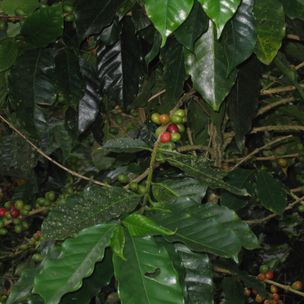
Coffee - a very popular drink in Germany. Do you also like drinking coffee? Then take a look where the coffee in our stores comes from. Aquiares is a beautiful place to learn about the whole process of coffee production from cultivation, harvesting and processing to roasting. At the foot of the Turrialba volcano, excellent coffee is grown on very fertile soil and at an altitude of 800 to 1500 meters. The finca measures over 900 hectares, of which about 300 hectares are protected as rainforest. Aquiares is located between the rivers Aquiares and Turrialba, hence the name. Aquiares is an indigenous word for "between the rivers". Aquiares is known for excellent quality and sustainable cultivation. The farm is certified by the Rainforest Alliance and adheres to strict Starbucks standards.
Aquiares has its own coffee processing facility - a plant (Beneficio), and processes only its own coffee, which on the one hand guarantees consistent high quality and ensures quality control.
A short detour to Aquiares is worthwhile to learn about the cultivation and processing of coffee, but also for the beautiful view of the Turrialba Valley.
Banana plantations
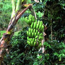
Until a few years ago, banana export was one of the main pillars of Costa Rica's economy. Four large container ships operate permanently between Limón and Hamburg, carrying bananas only. Large banana plantations are located on the Caribbean coast between Limón and the border to Panamá. It is certainly interesting to see where the bananas in our supermarket come from, how they are grown, harvested and shipped. A visit to a banana plantation is worthwhile.
If you have some time on your way back, you should have a look at the loading of the banana containers in the port of Limón. It is quite an impressive spectacle how smoothly hundreds of containers are loaded one after the other onto the ship without losing even a second of time – it is really impressive how well organized this is.
Here are a link to a tour provider: Hacienda Aquiares www.aquiares.com
Sugar cane
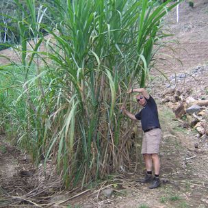
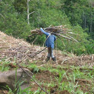
More than 100 years ago, Hacienda Juan Viñas was founded, geoprahically located between the two volcanoes Irazu and Turrialba. Coffee, sugar cane and macadamia nuts are grown on 3200 hectares of fertile volcanic soil at an altitude of 1000 to 1500 meters. Sugar cane is cultivated conventionally and partially organically on 1800 hectares alone. Traditionally, Hacienda Juan Viñas is committed to its workers and maintains several social projects. It offers good living conditions on and around the hacienda. Providing over 400 housing units, medical care, education and training for its employees and their families. The owners are particularly concerned about the education of their employees' children. Within the finca there are eight villages, each with its own school. In addition, the hacienda adheres to strict environmental protection standards. A reforestation program helps prevent soil erosion. The finca has its own water treatment plant and the largest and most advanced composting facility in the country. Those interested in sugar production can learn about the process at the hacienda's own sugar factory (Ingenio).
Adventure
To Orosi and Tapanti via Tucurrique - Beautiful offroad route
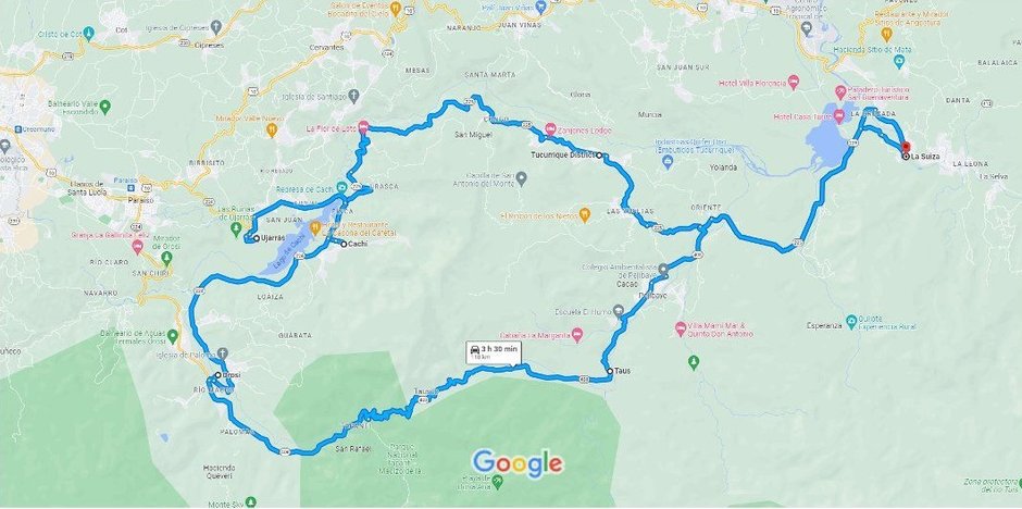
After Orosi, instead of taking the country road, you can choose a nice off-road route. Drive from La Suiza in the direction of Turrialba. After about 5 km turn left on the 225 towards Atirro, so turn off before you reach Lake Angostura. Then stay on this road until you reach the Cachi reservoir via Tucurrique. Drive past the lake on the left to Orosi. If you want to admire a beautiful view over the whole Orosi Valley, you should drive to the right around the Cachi Lake via Ujarrás. From Orosi, continue to Tapantí and take the 408 through Selva, Taus, Humo and Pajibaye to the 225 and finally back on the road to La Suiza. If you like paddling, you can book a tour on the Rio Pejibaye. The entry point is behind the school in Taus. From there you will go downstream by canoe. The Rio Pejibaye is very scenic.
Across the Tierra de Los Santos to Quepos
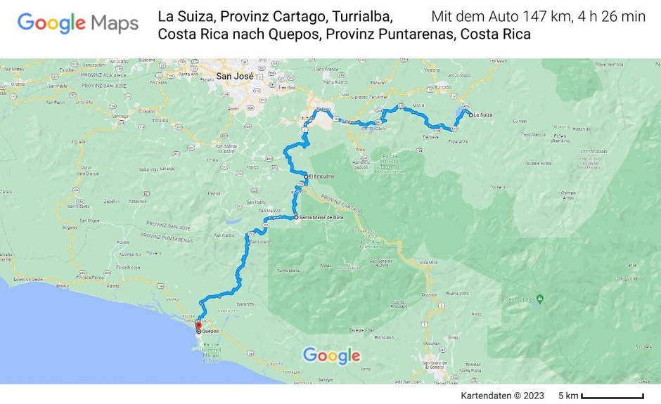
Breathtaking view - beautiful offroad routeI have driven this route several times with my motorcycle and just two years ago with my girlfriend in a small jeep. It is always fun. First, drive from La Suiza in the direction of San José. When you get to the Panamericana in Cartago, don't follow it to San José, but go south towards San Isidro de El General. After about 20 km at El Empalme, leave the Interamericana (2) and turn right onto the 226 towards Santa María de Dota. Follow the road until Tres Marías and then turn left onto the 303. A few kilometers after San Marcos, leave the alpine road and turn left onto a dirt road. Quepos should already be signposted here. It is about 35 km. Drive along the Rio Pirrís via Nápoles and Naranjito to Quepos.
Already from Santa María you will have breathtaking views of the surrounding mountains. The Zona de Los Santos is famous for the best coffee in Costa Rica. You can see the coffee plantations on the slopes of the mountains. It is especially beautiful if you are there during the flowering season. Then the coffee trees are covered with a white veil. On the gravel road you will soon reach rainforest. It is not unusual that the weather in the jungle piece is different than outside. You may have had bright blue skies up to that point, and in the rainforest it is misty or even raining. Therefore, the road may be wet and therefore slippery. So drive slowly and enjoy the lush vegetation. After about 1 1/2 to 2 hours of driving, you will come to a small restaurant - a soda as the Ticos say - that seems to float on the mountain. The road leads directly over the crest of a ridge and a breathtaking panoramic view opens up. The little soda is built on stilts right into the hillside. It is worthwhile lingering here for a bit and enjoy the view. Continuing you will soon get out of the jungle and drive through huge palm oil plantations. In Quepos you can visit the Manuel Antonio National Park, which offers very nice beaches. Personally, I prefer to follow road 34 a bit further southeast to Playa Matapalo or especially Playa Dominical, as it is a bit quieter there. At Dominical, you can leave 34 north to San Isidro de El General and then drive back to La Suiza via Cartago over the Cerro de la Muerte, whose pass is at 3,451 meters.
The drive is worth it, as it is simply fun to be off the beaten path with a small off-roader.
